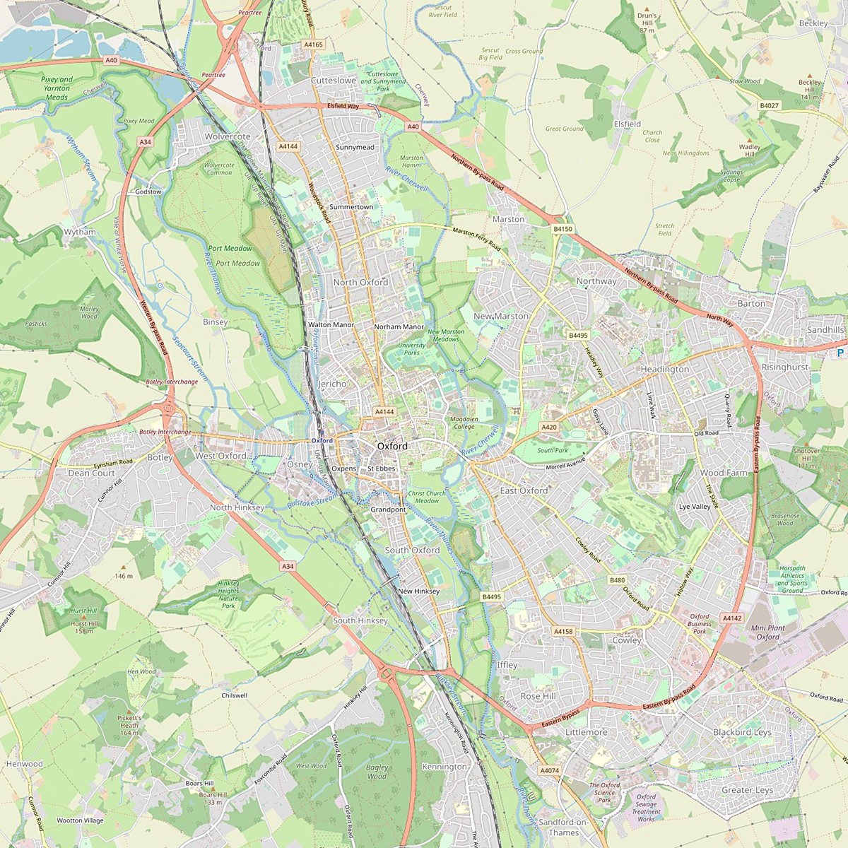
Oxford is a very watery city. A map can show you how water has dominated the development of this ancient settlement and its growth through the centuries. On the west it is bordered by the River Thames (known as the Isis as it flows through Oxford) which loops round to form the southern boundary where it is joined by the Cherwell, a river that forms the eastern border of the city. The name Oxford means a place where the cattle could cross the river in the years before bridges were built. Such places with very shallow water are known as fords. The Isis, as it reaches what is now Oxford, breaks up into several streams and small waterways which the cattle could wade across as they plodded after the drovers to markets downriver. Such a useful crossing place led to the growth of a small town which has certainly been inhabited since Roman times.
These two rivers are not large – the Isis is about 76 metres at its widest and the Cherwell considerably smaller - but both of them are liable to significant winter flooding. We call the land which is regularly flooded on either side of a river the ‘flood plain’. To the north there was room for the city to expand on a narrow low ridge between the two rivers, as it did in the nineteenth century, but even here the dry land is often less than a kilometre in width between the flood plains of the Isis and the Cherwell.
When industrialisation in the early twentieth century attracted many thousands of people to Oxford, they had to settle on the higher land on the far side of the Cherwell, connected to the original city by Magdalen Bridge and a narrow strip of land with flood water on both sides. This explains the odd shape of Oxford in which watery fields and farms reach into the very centre, and cows graze within four hundred metres of Carfax, the original crossroads of the city. The west is dominated by Port Meadow, a huge expanse of land along the Isis that has belonged to the people of Oxford since the eleventh century for their exercise and recreation. By law, tradition and common-sense, nothing is built on the Meadow: even with modern drainage methods, the Isis floods every winter, and sometimes even in summer in our era of climate change.
However, Oxford has its own industrial waterway, the Oxford Canal, by which the city was linked to the extensive eighteenth-century canal network which carried raw materials and manufactured goods from the Midlands and the North across the country. The Oxford extension, 124 kilometres long, was built from 1770 to 1790, and was in operation as a commercial waterway until the 1950s. The canal enters the city from the north and follows a route through the western edge of the built-up area, closer to the city than the Isis. This is possible because the canal, having a controlled amount of water, does not flood. Wharves for unloading goods from the canal boats, boatyards for repairs, turning points, lift bridges and, most importantly, locks, were constructed within the city itself. Canal barges, pulled by horses, carried all kinds of goods, of which the most important was coal. Coal came from mines in the Midlands, and heated the individual homes of the Oxford population as well as factories and industrial works. Originally the canal ended at extensive wharves in the city centre. This last section was filled in when commercial canal traffic had dwindled to almost nothing after the Second World War; it is now a car park.
Many English canals fell into disuse after the war, but the Oxford Canal quickly became a place for houseboats, pleasure boats, and canal ‘narrow boats’ turned into holiday touring craft, while the canal towing path along which horses used to plod, pulling the coal barges, is now a busy pedestrian and cycle path, a pleasant ‘green lane’ through the city.
Oxford’s first water works were constructed in the late seventeenth century, but it was not until the nineteenth century that the supply was cleansed by being filtered through sands. (Henry Taunt who took some of the older photographs in this exhibition complained that the water supply to his house contained many small crayfish.) In the mid-twentieth century a large reservoir was dug at Farmoor, about 8 kilometres outside Oxford. Water from the Thames is pumped up to the reservoir and then piped downwards to provide clean, filtered water for the city.
Clearly the contrast with Perm is immense; there are no big embankments along the Isis and Cherwell, and therefore no grand buildings or industrial plants. Instead the rivers are used for sports such as rowing and sailing, for leisure cruises, for swimming and punting, for fishing and birdwatching and enjoying nature. Those of you who have ever watched the Oxford and Cambridge Boat Race on television may have seen the Oxford Crew practising on the Isis in the south of the city. Those of you who have enjoyed Swan Lake would be able to see many swans on our rivers, including, occasionally, a Black Swan. Fishermen can catch pike, perch, roach and even carp in our rivers, but the Oxford climate means that the water very rarely freezes over (the last time was in 1963) so ice fishing is not possible. The very distinctive Oxford entertainment is punting on the Cherwell with a special flat-bottomed boat and a long pole. Skilled punters can steer the punt even when the pole has plunged into muddy bottomless depths – but for those who are punting for the first time, the chances of losing your pole and toppling into the water are very high.
Above all, the Oxford river system has provided inspiration to those who have wandered along its banks, like Kenneth Graham who wrote the story of Ratty, Mole and Mr Toad in The Wind in the Willows, or who have taken out a small boat, like Lewis Carroll who rowed three little girls up the Isis to Godstow, and on the way began his story of Alice in Wonderland.
Karen Hewitt
Notes:
The photos shown here were taken from several sources. The Oxfordshire History Centre provided many of the images from its different archives; others came from individual special collections. Oxford City Council and the Oxford Perm Association are grateful for the support they have received. We would particularly like to thank Stephanie Jenkins for her generosity in providing 5 of the flood images from her OxfordHistory archive, and Helen Drury at the Oxfordshire History Centre for her help in sorting out our diverse requests for images.
At the beginning of the twentieth century, the best-known photographer in Oxford was the remarkable Henry Taunt. His scenes include daily life and work in Oxford and Oxfordshire, natural life along the rivers, and grand festivals such as his two photos shown here of Eights Week. The photos by Taunt are identified as such.
The people who took part in this project are all members of the Oxford Perm Association
- Mark Davies, Co-ordinator; local historian and provider of most of the captions
- Jill Hind, local historian and specialist on Oxford water supplies
- Chris Cowley
- Julia Slater
- Daniel Scharf
- Cynthia Watson
- Rip Bulkeley
- Marianne Talbot
- Karen Hewitt, writer of the Introduction, and responsible for liaison with Perm
Oxford, Rivers Thames & Cherwell
Sections