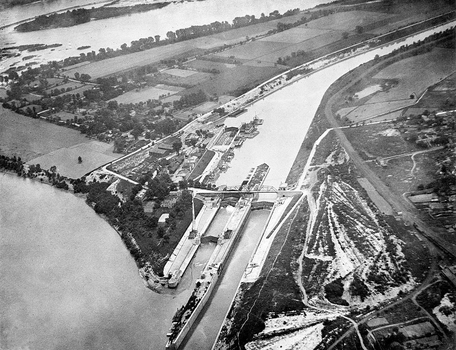
Aerial view of Louisville and Portland Canal, Louisville, Kentucky, 1922. Completed in 1830, the locks and dam were the first large scale engineering waterway project on the Ohio River. The canal served as a bypass for the Falls of the Ohio, increasing access and ease of travel for merchants. Following extensive improvements and modernization by the government, the name was changed to McAlpine Locks and Dam in 1962.
From the Caufield & Shook Collection, University of Louisville Archives & Special Collections.
Steamer Shepperd & Tow entering locks of canal, Kentucky, 1928. S The K & I Bridge is visible in the background. The Louisville and Portland Canal bypassed the Falls of the Ohio on the Ohio River, allowing more ships carrying goods to navigate the river. The two-mile canal was completed in 1830.
From the Caufield & Shook Collection, University of Louisville Archives & Special Collections.
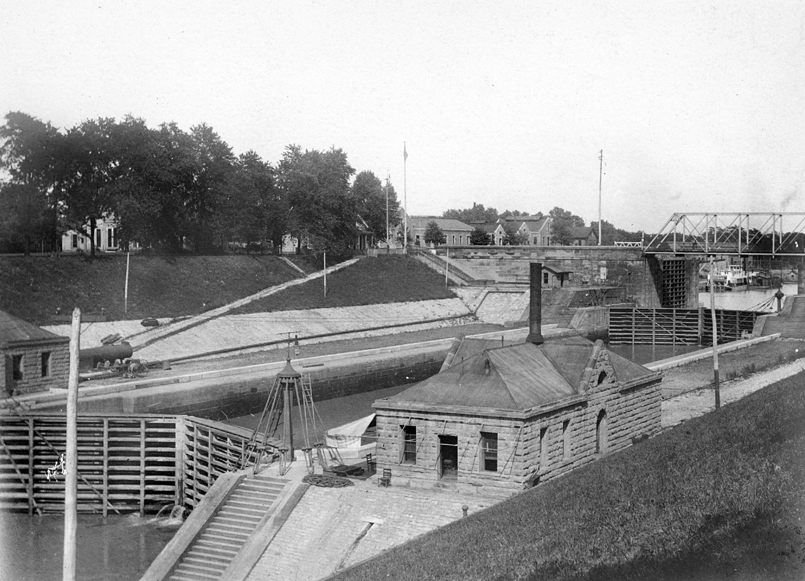
Canal lock, Louisville, Kentucky, July 27, 1907. Lock of the Louisville and Portland Canal, on the Ohio River, looking north (upstream) to Shippingport Island. The Canal later became the McAlpine Dam and Locks.
From the A.W. Terhune Collection, University of Louisville Archives & Special Collections.
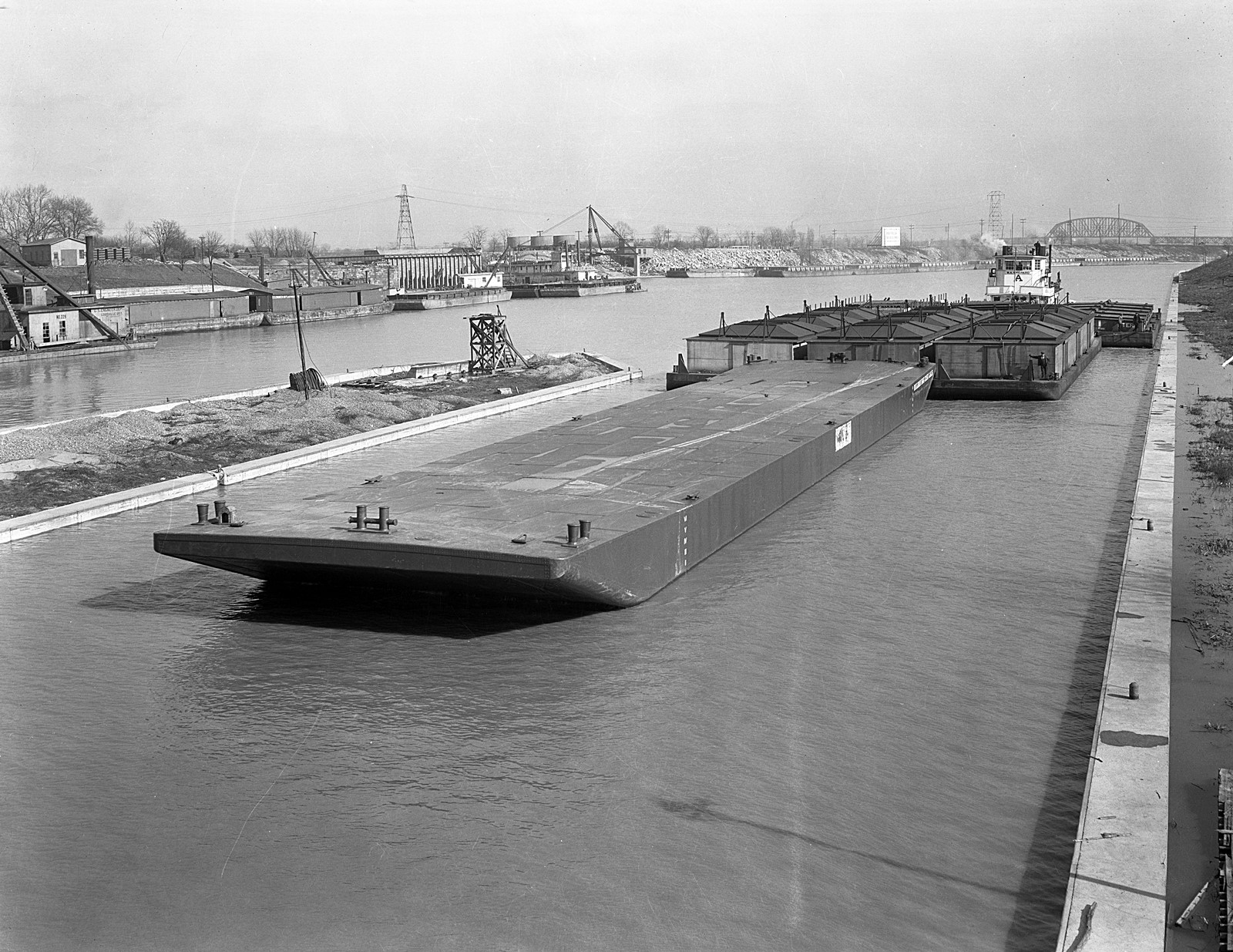
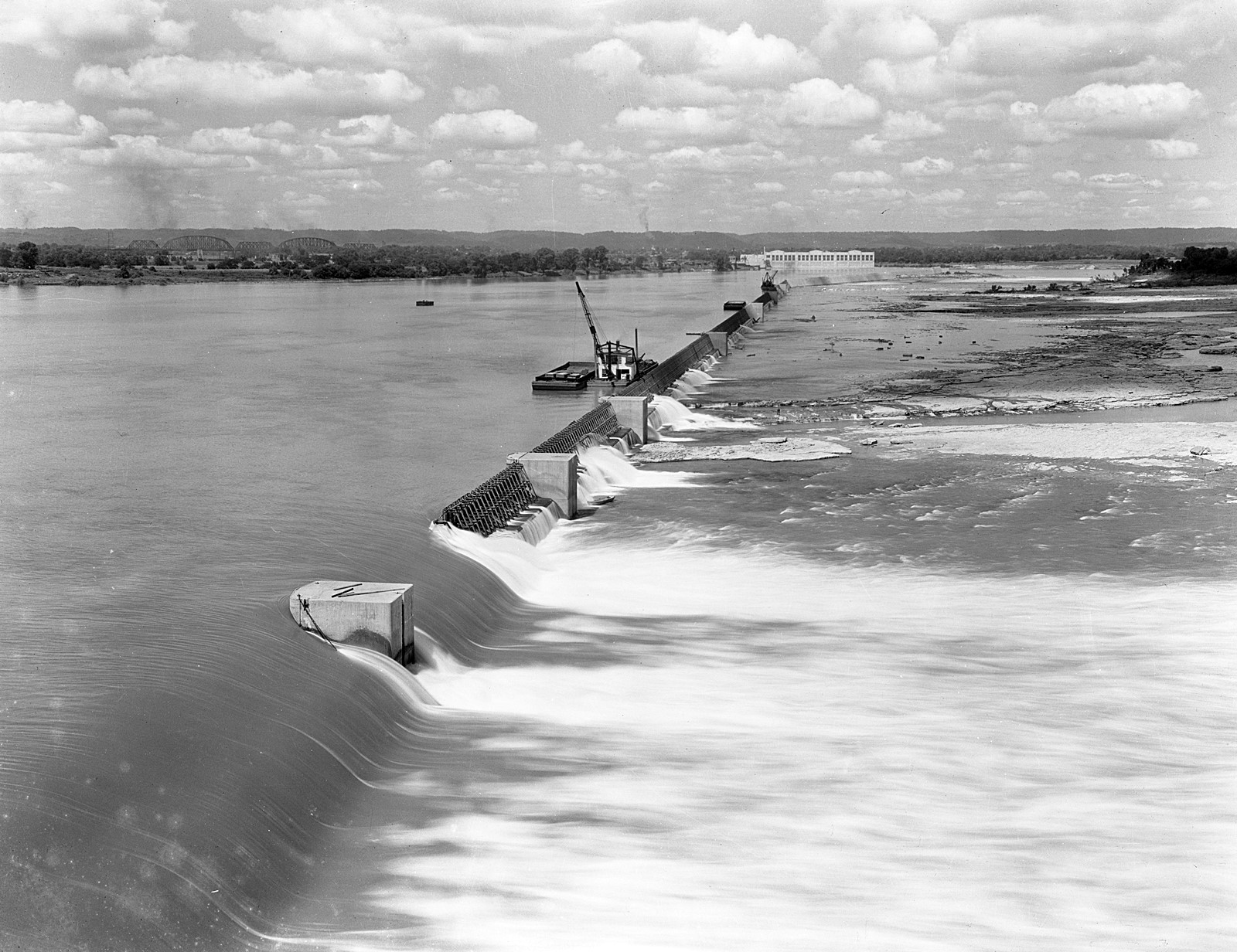
Dam 41, Portland Canal, Louisville, Kentucky, 1928. The Louisville and Portland Canal bypassed the Falls of the Ohio on the Ohio River, allowing more ships carrying goods to navigate the river.
The two-mile canal was completed in 1830. From the Herald-Post collection, University of Louisville Archives & Special Collections.
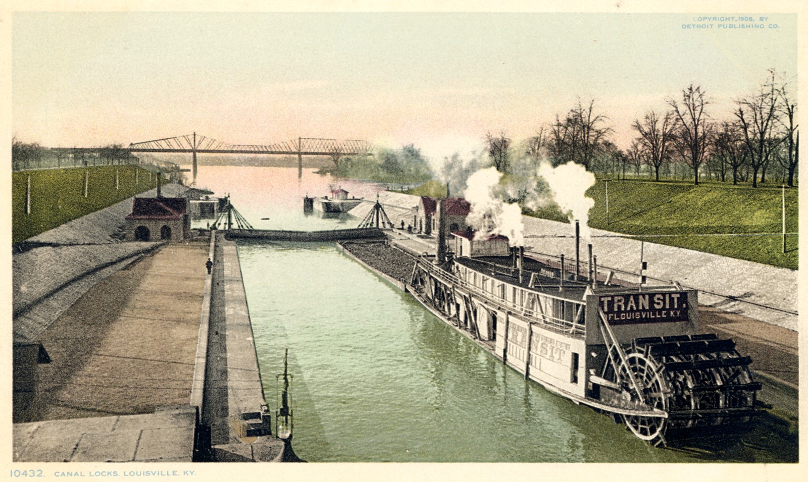
View down the canal, canal locks, Louisville, Kentucky.
From the Newton Owen Postcard Collection, University of Louisville Archives & Special Collections.
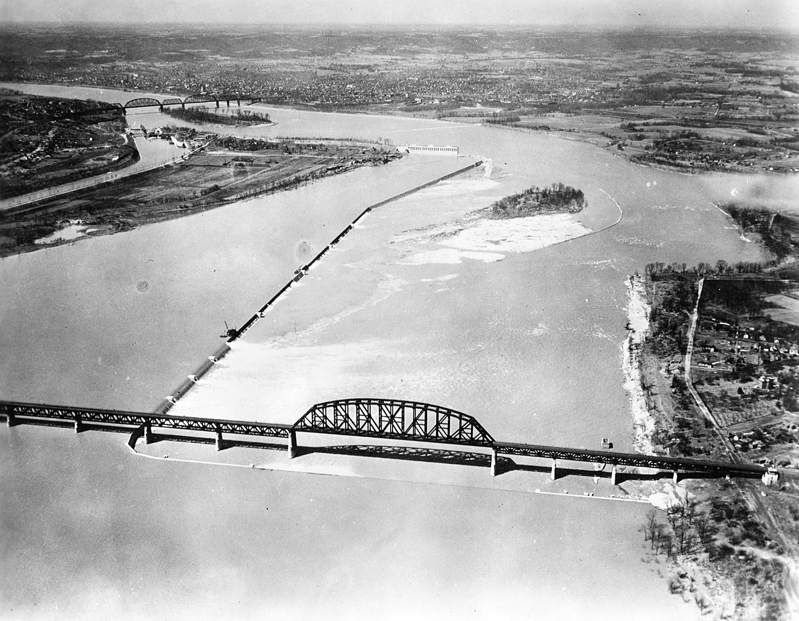
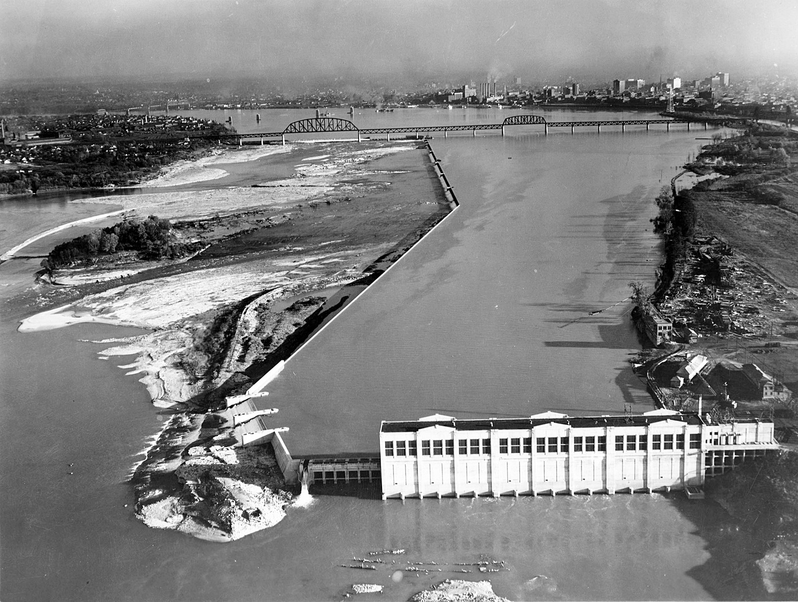
Dam and Louisville Hydro Electric Power Plant, Louisville, Kentucky, 1928. A view of a dam on the Ohio River looking downstream towards the Louisville Hydro Electric Power Plant.
From the Caufield & Shook Collection, University of Louisville Archives & Special Collections.
Louisville Hydro Electric Company powerplant, Ohio River Falls, Louisville, Kentucky, 1929.
From the Herald-Post collection, University of Louisville Archives & Special Collections.
Fourteenth Street/Pennsylvania Railroad Bridge, Louisville, Kentucky, 1920. Designed by L & N chief engineer Albert Fink and completed in 1870, this bridge was the longest iron bridge in the United States at the time. Purchased by the Pennsylvania Railroad in the late 1870s, the bridge is also known as the "Pensy" bridge.
Item CS 034058 in the Caufield & Shook Collection, University of Louisville Photographic Archives.
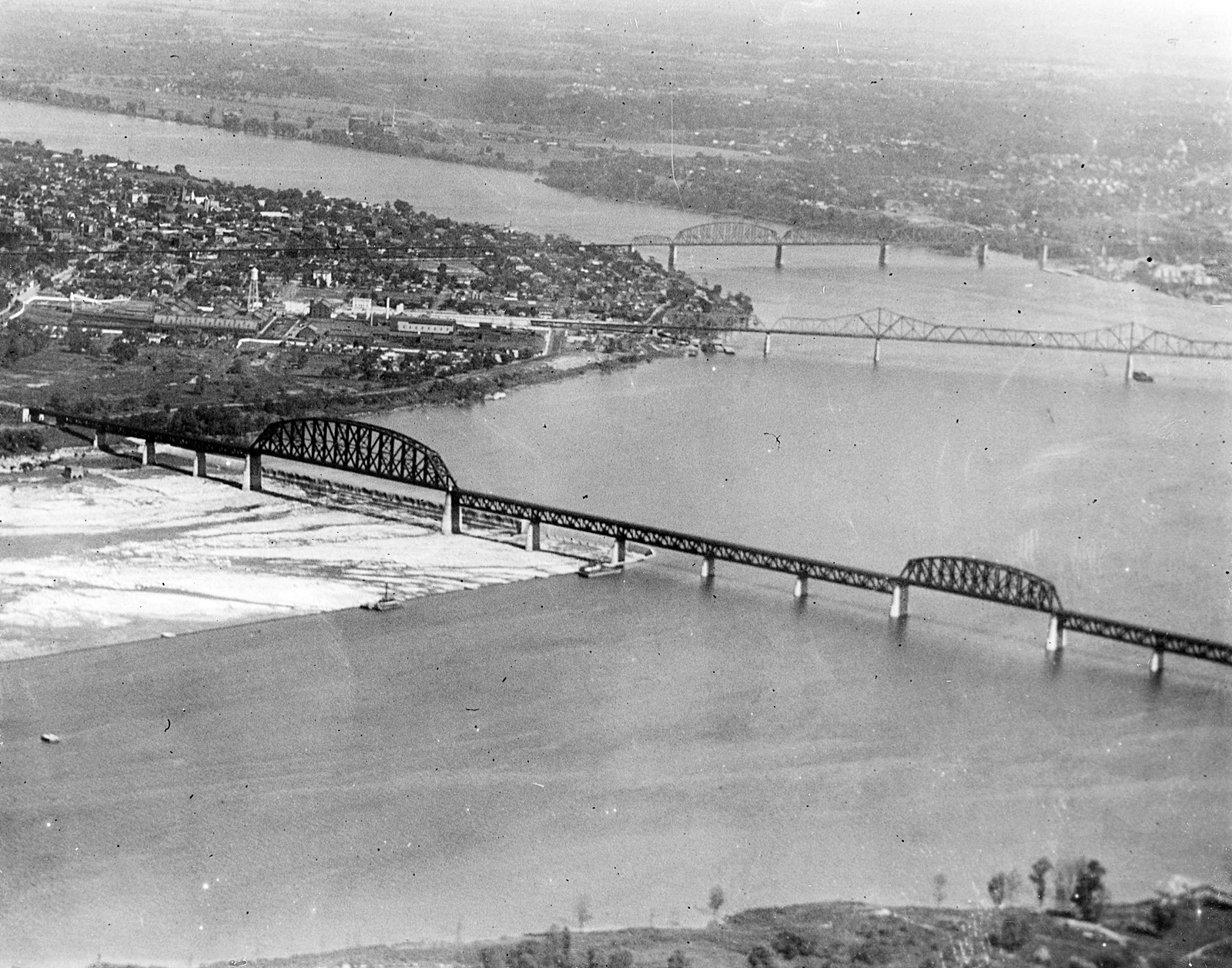
Fourteenth Street/Pennsylvania Railroad Bridge, aerial view, Louisville, Kentucky, 1929. An aerial view of the Pennsylvania Railroad Bridge.
From the Caufield & Shook Collection, University of Louisville Archives & Special Collections.
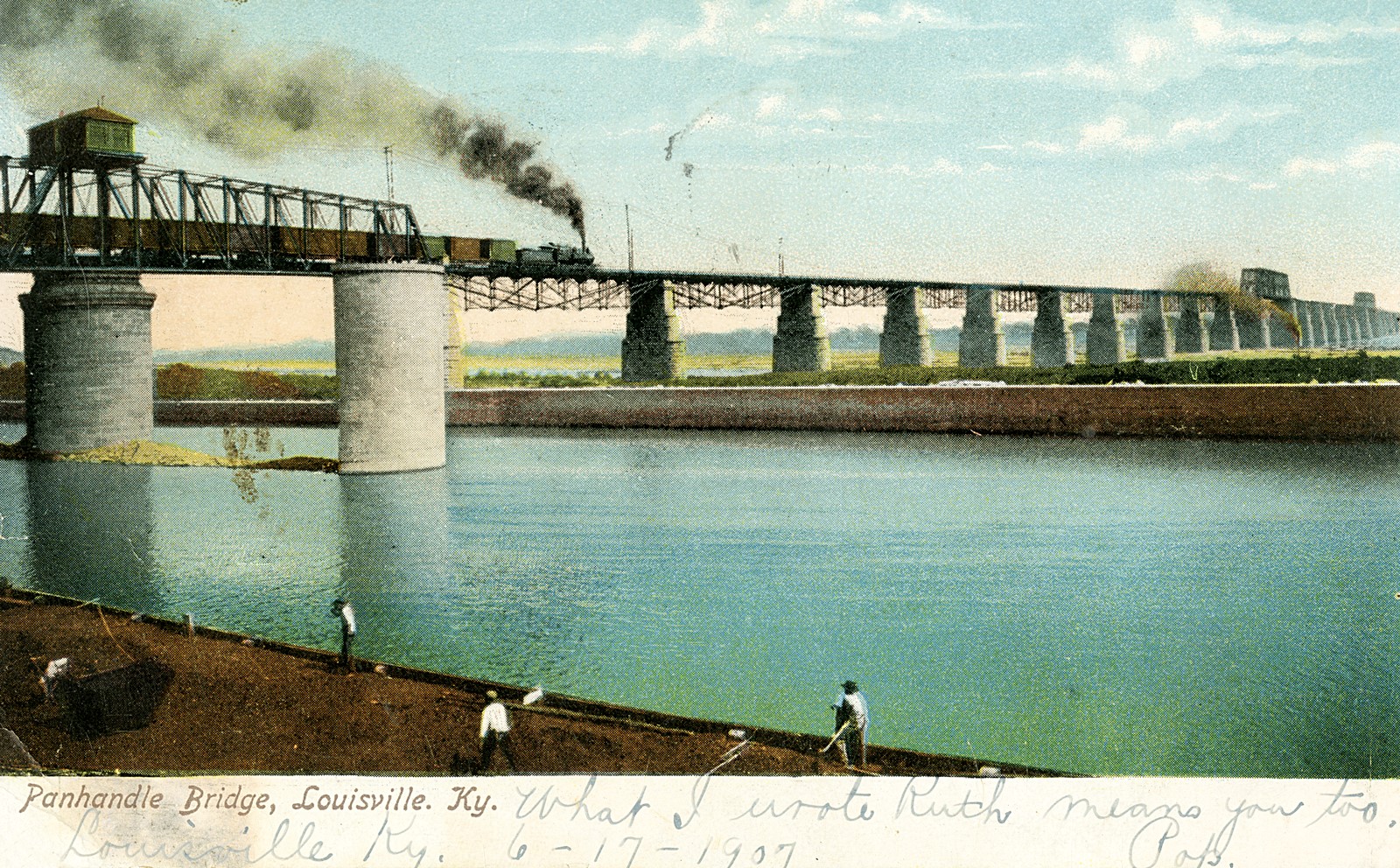
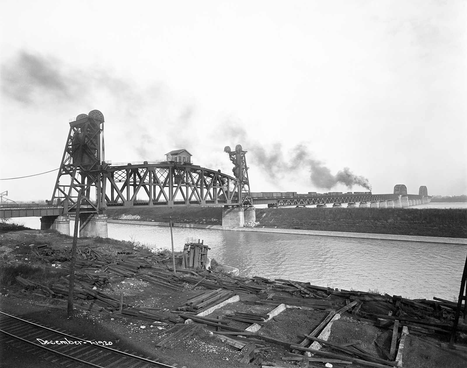
Panhandle Bridge over the Ohio River at Louisville, Kentucky. This bridge, known also as the Pennsylvania Railroad Bridge, spanned the Ohio between Louisville and Clarksville, Indiana, and was completed in 1870. It featured a rotating trestle to allow boat traffic along the Portland Canal. It was replaced in 1917 by the Fourteenth Street Bridge.
From the A.W. Terhune Collection, University of Louisville Archives & Special Collections.
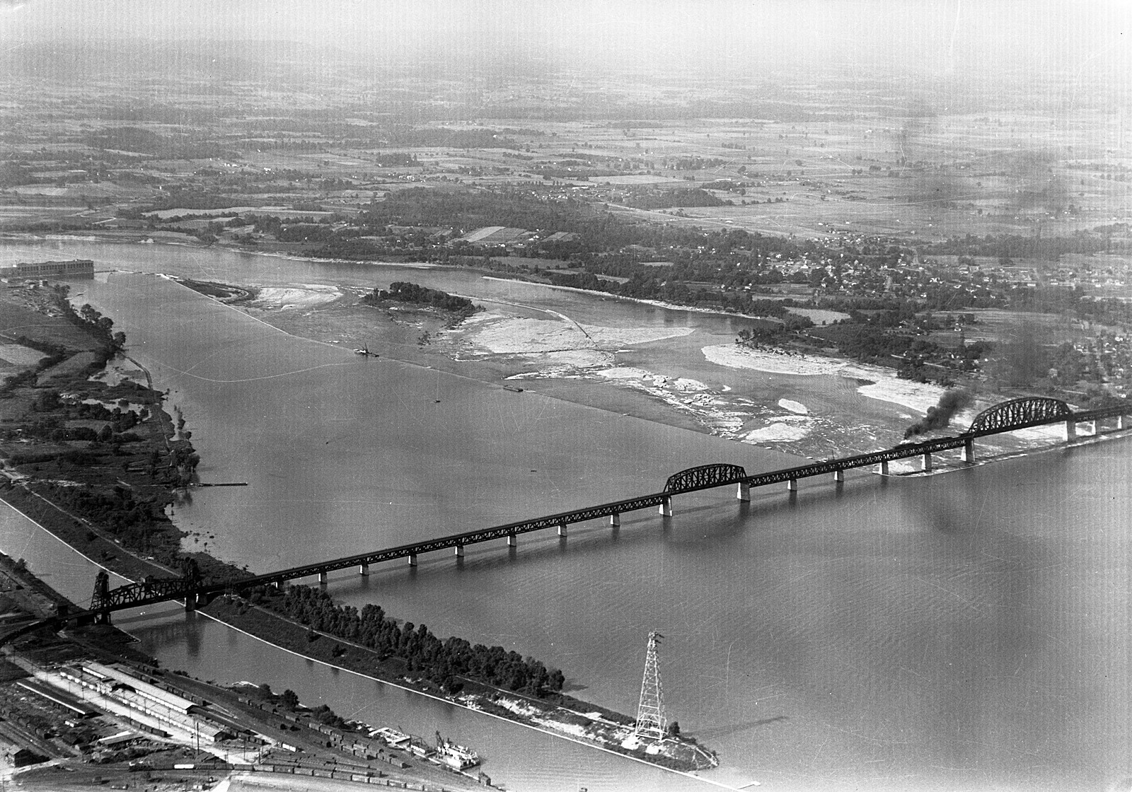
Fourteenth Street/Pennsylvania Railroad Bridge, Louisville, Kentucky, 1929. Photograph shows three bridges connecting the City of Louisville with Indiana at the outer river bend.
From the Herald-Post collection, University of Louisville Archives & Special Collections.

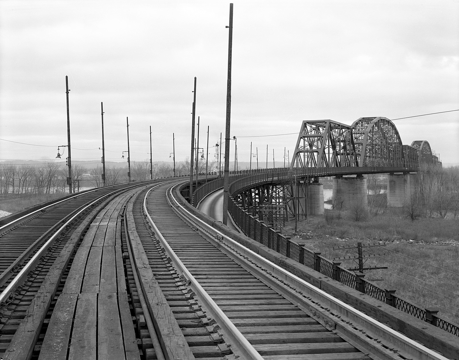
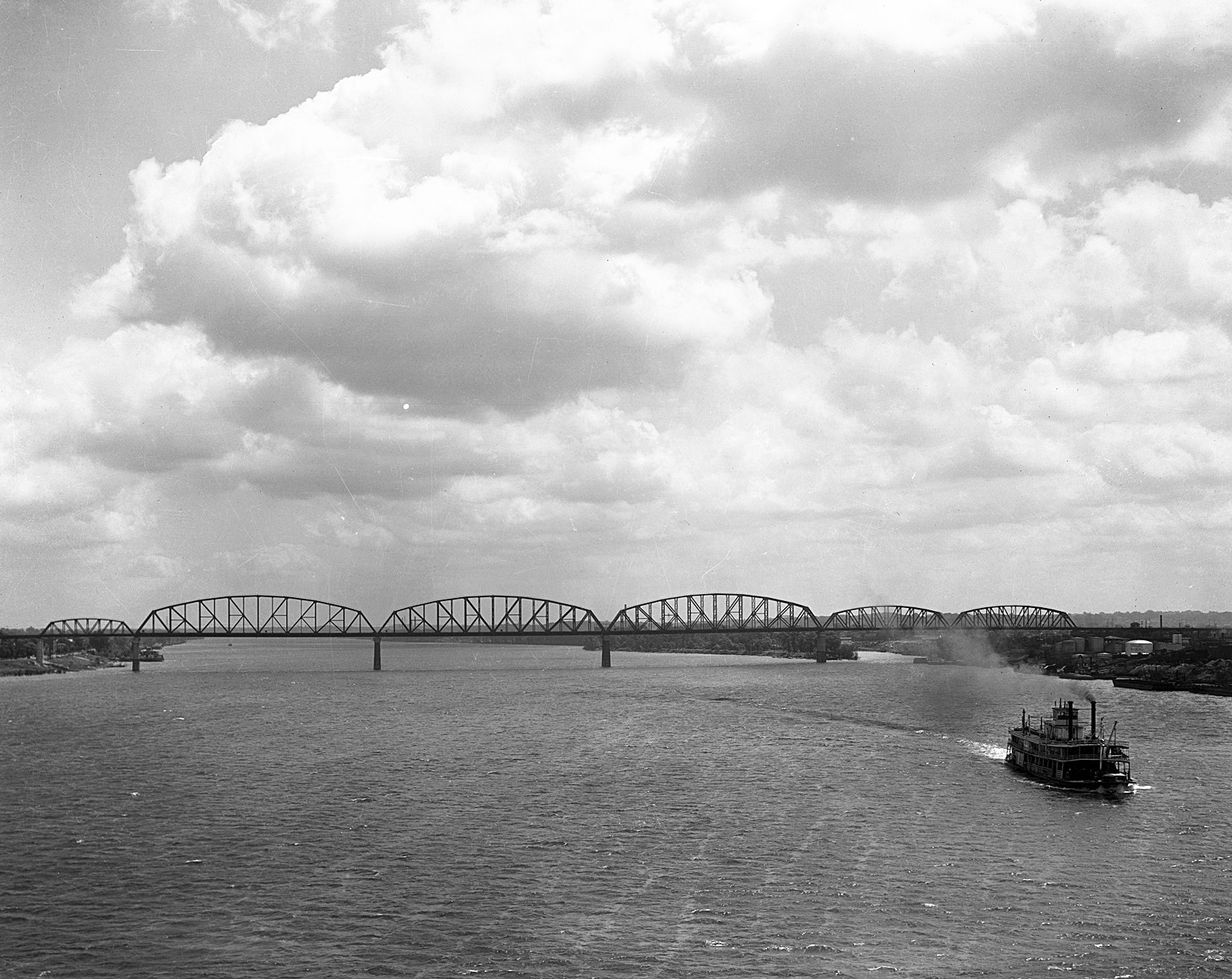
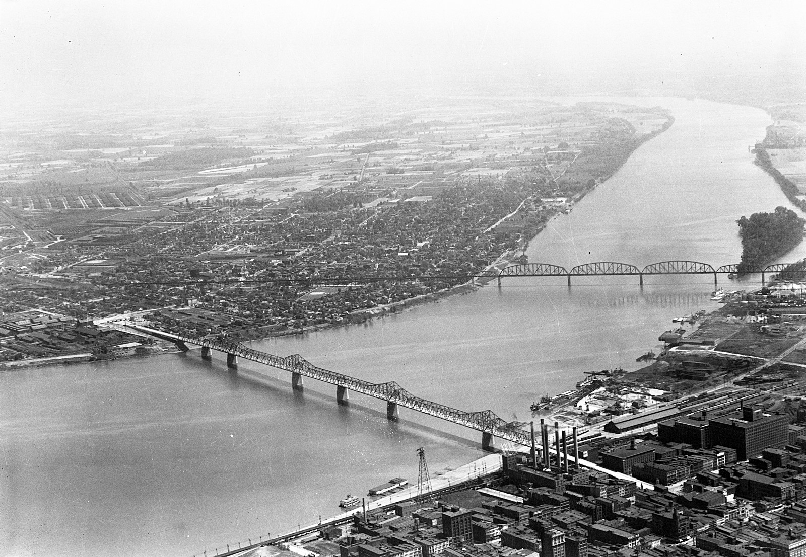
Aerial view of Kentucky and Indiana Bridge, Louisville, Kentucky, 1922. The K&I Bridge connects Louisville, Kentucky to New Albany, Indiana. The bridge was constructed between 1881 and 1885 by the Kentucky and Indiana Railroad Company, and officially opened to both rail and pedestrian traffic in 1886.
From the Caufield & Shook Collection, University of Louisville Archives & Special Collections.
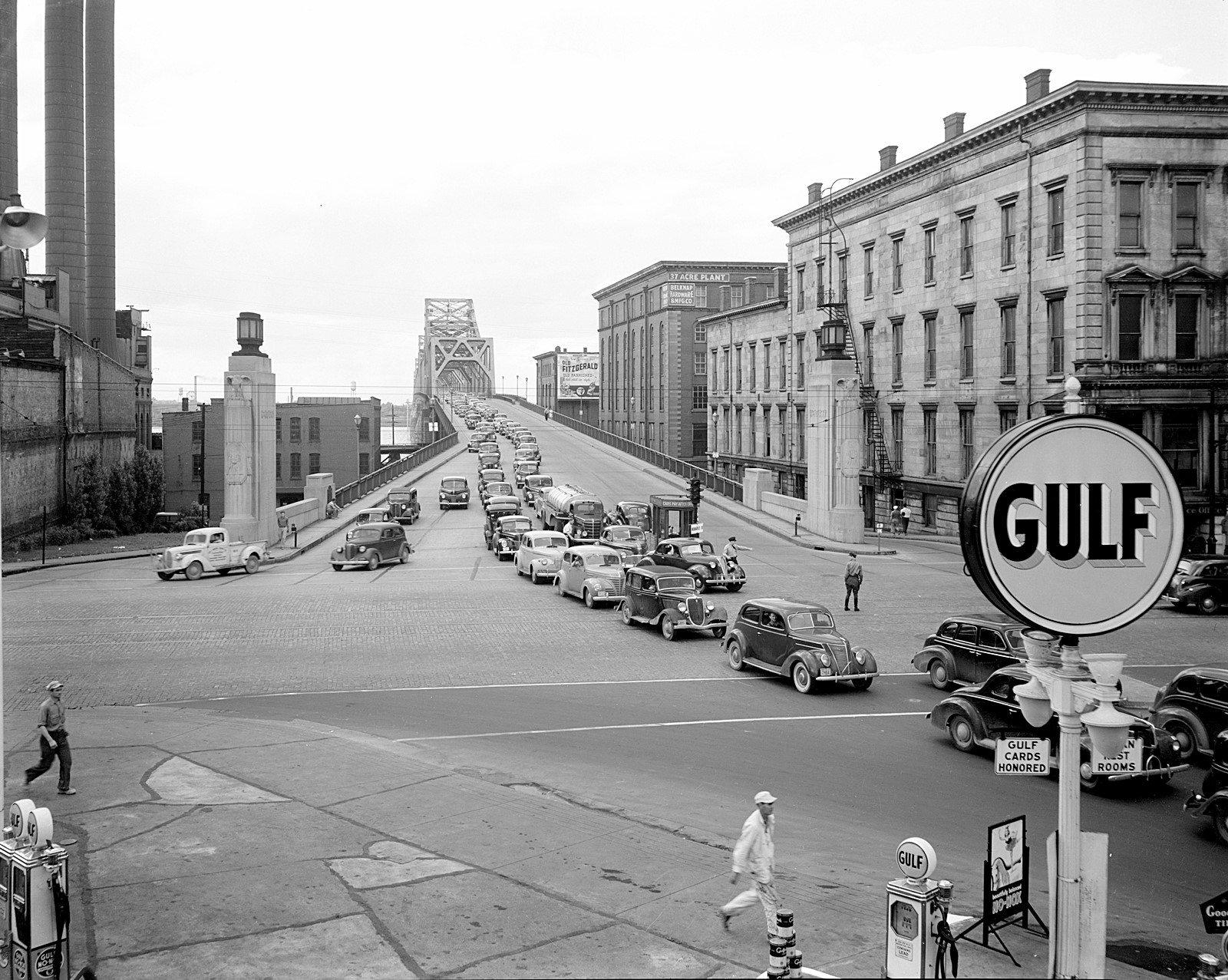
Kentucky and Indiana Bridge, Louisville, Kentucky, 1957. Taken from the center of the railroad tracks, this is a view towards the Kentucky and Indiana Terminal Bridge that crosses over the Ohio River.
From the Caufield & Shook Collection, University of Louisville Archives & Special Collections.
Big Four Bridge, Louisville, Kentucky, 1930. A view taken from the Municipal Bridge.
From the Caufield & Shook Collection, University of Louisville Archives & Special Collections.
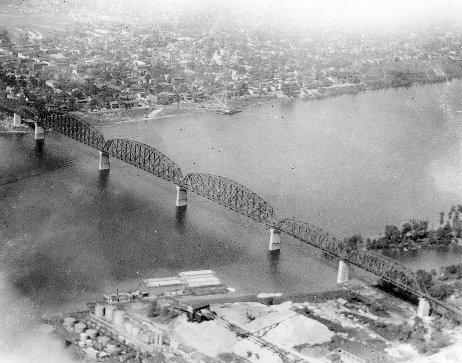
Aerial view of Big Four Bridge, Louisville, Kentucky - Jeffersonville, Indiana, 1929.
From the Herald-Post collection, University of Louisville Archives & Special Collections.
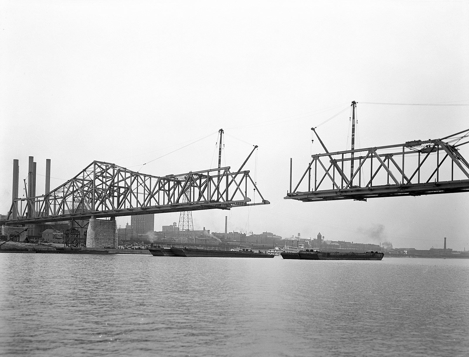
Municipal Bridge (now known as the Second St. Bridge or George Rogers Clark Memorial Bridge) construction, Louisville, Kentucky, 1929.
From the Caufield & Shook Collection, University of Louisville Archives & Special Collections.
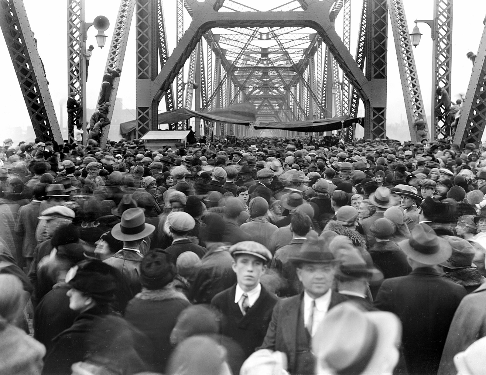
Crowd at opening of Municipal Bridge, Louisville, Kentucky, October 1929. Designed by architect Paul Cret and Philadelphia engineering firm Modjeski and Masters, the bridge cost $4.7 million, to be offset by a toll, and took one year to construct. The bridge was later renamed the George Rogers Clark Memorial Bridge.
From the Caufield & Shook Collection, University of Louisville Archives & Special Collections.
Municipal Bridge (now known as the Second St. Bridge or George Rogers Clark Memorial Bridge), aerial view, including other bridges at Louisville, Kentucky, 1930. An aerial view of the newly constructed Municipal Bridge that spans the Ohio River and connects Louisville, Kentucky to Jeffersonville, Indiana. The bridge was renamed the George Rogers Clark Memorial Bridge in 1949 and is commonly referred to as the Second Street Bridge.
From the Caufield & Shook Collection, University of Louisville Archives & Special Collections.
Traffic on the Municipal Bridge (now known as the Second St. Bridge or George Rogers Clark Memorial Bridge), Louisville, Kentucky, 1941. Originally known as the Municipal Bridge, the George Rogers Clark Memorial Bridge or the Second Street Bridge spans the Ohio River between Louisville, Kentucky, and Jeffersonville, Indiana.
From the Caufield & Shook Collection, University of Louisville Archives & Special Collections.
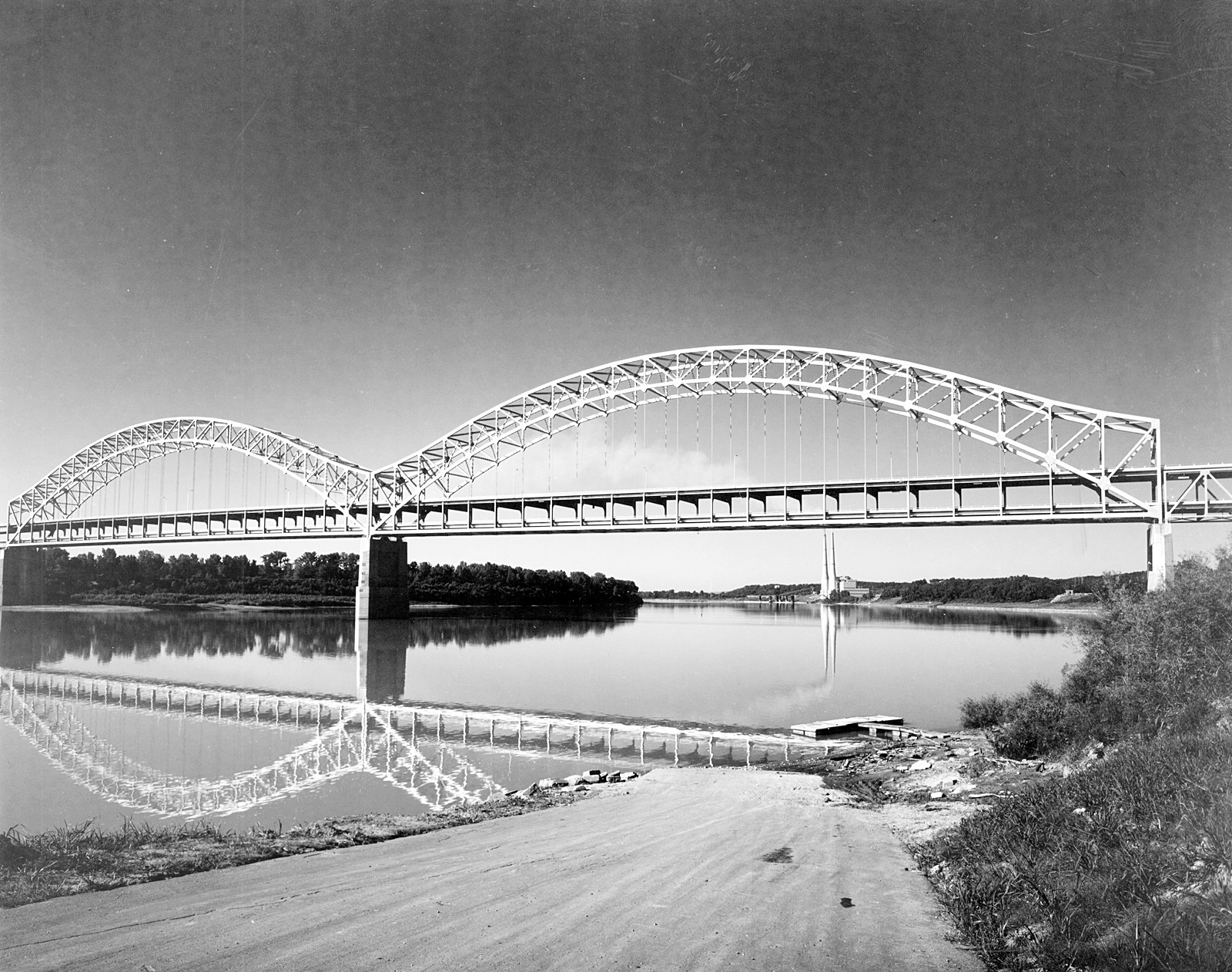
Sherman Minton Bridge as its construction neared completion, 1962. The double-deck bridge between Louisville, Kentucky, and New Albany, Indiana, is named for U. S. Supreme Court Justice Sherman Minton, a native of New Albany.
From the Caufield & Shook Collection, University of Louisville Archives & Special Collections.
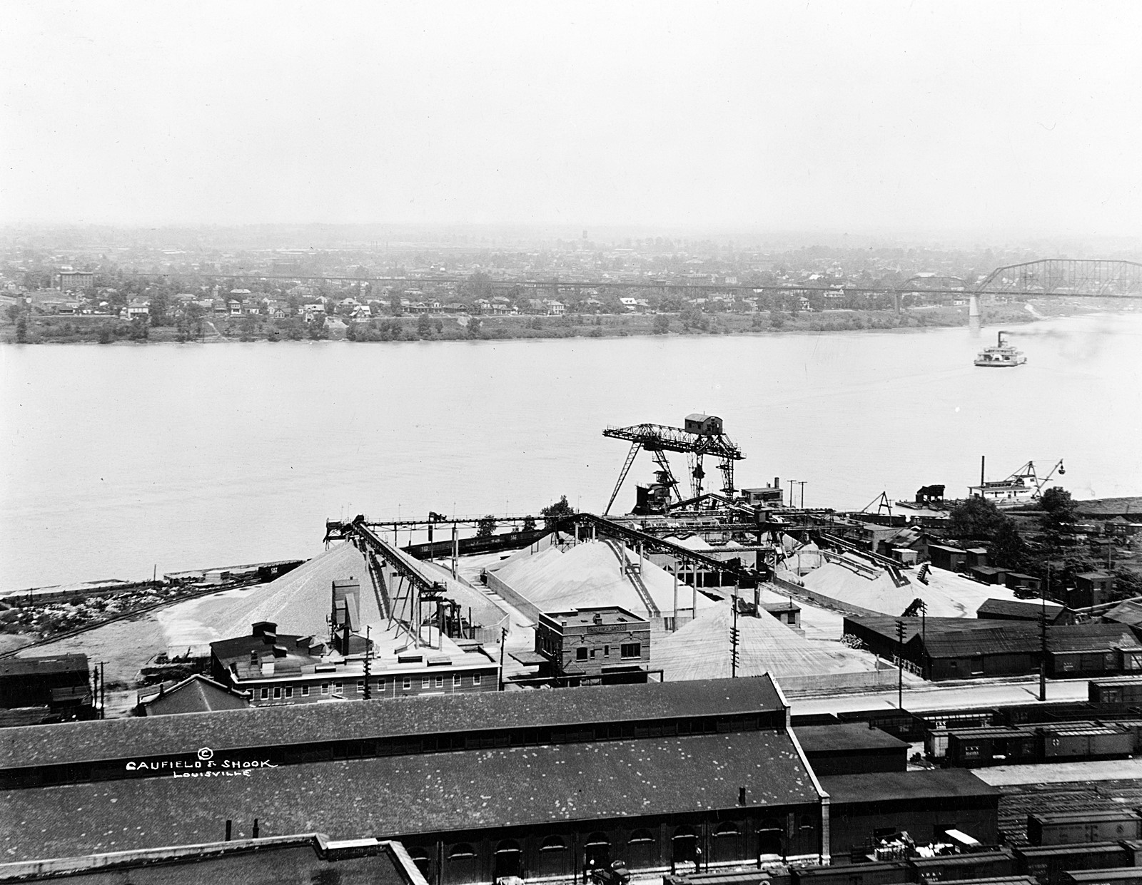
Ohio River Sand Company, Louisville, Kentucky, 1926. Sand is heaped in piles at the Ohio River Sand Company along the Ohio River.
From the Caufield & Shook Collection, University of Louisville Archives & Special Collections.
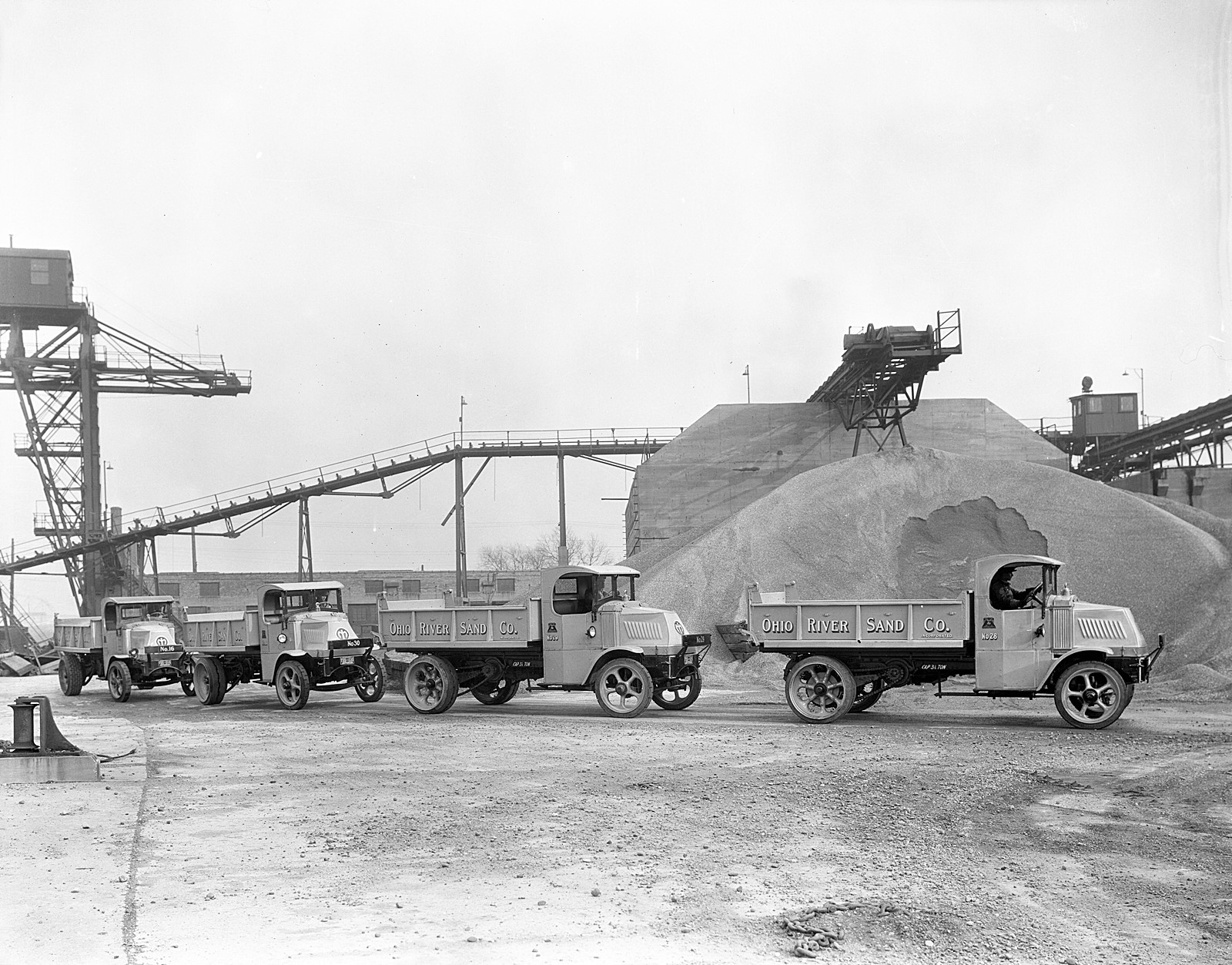
Ohio River Sand Company trucks, Louisville, Kentucky, 1929. Four Ohio River Sand Company trucks drive through the company's lot in Louisville, Kentucky.
From the Caufield & Shook Collection, University of Louisville Archives & Special Collections.
Sections:
Louisville
Section 4. ConstructionsThe Falls of the Ohio provided the impetus for Louisville’s founding, but it is a double-edged sword. While it was advantageous to be situated at the only portage point on the river, merchants wanted their goods to travel without obstructions. As a result, the first structure built to make the river more navigable was a canal, completed in 1830. A power plant was added to an enhanced canal and dam structure in the early 20th century. As railroads and then highways were constructed, the river itself was the obstruction to travel. The first bridge over the Ohio at Louisville was completed in 1870. The Kentucky & Indiana Bridge followed, opening in 1886; the Big Four Bridge, completed in 1895; the Municipal Bridge, opened in 1929; the Sherman Minton Bridge, completed in 1962; the Abraham Lincoln Bridge, opened in 2015; and most recently, the Lewis and Clark Bridge opened in 2016.